Case Study: Geomagic Wrap Gives Researchers Clarity In Analyzing Sinkhole Survey Data
Documenting The AfterMath Of A Natural Disaster
Florida saw one of the largest sinkholes in the county in Pasco County near Saxon Lake in 2017. Measuring approximately 51 meters (wide) by 42 meters (high) with a depth of 40 feet, the sinkhole caused massive destruction to the community. The team from the University of South Florida’s (USF) Libraries and School of Geosciences, led by Drs. Lori Collins and Travis Doering, was brought in to assess and make sense of this natural disaster.
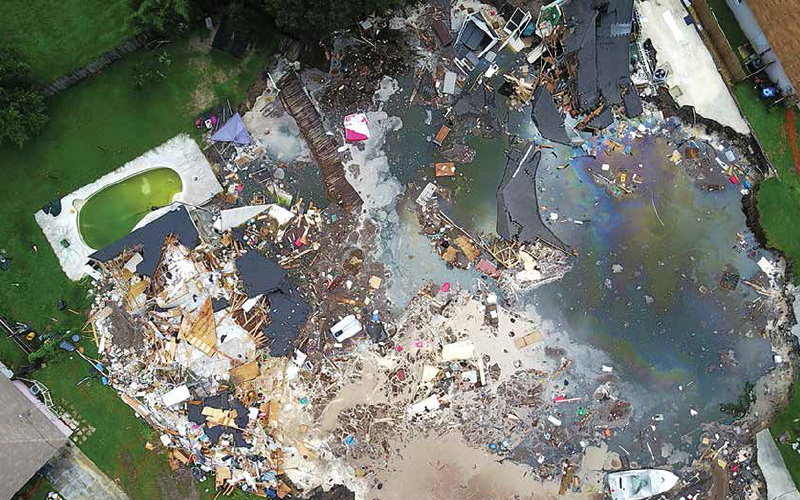
Collecting information from the scene is critical in predicting, managing, and controlling future sinkhole growth. Time is of the essence in making sure data was properly collected throughout its evolving nature. Data collection is only one part of the equation. Most important of all, the information must then be consolidated, processed, interpreted, and documented into meaningful ways to shed light on this natural disaster.
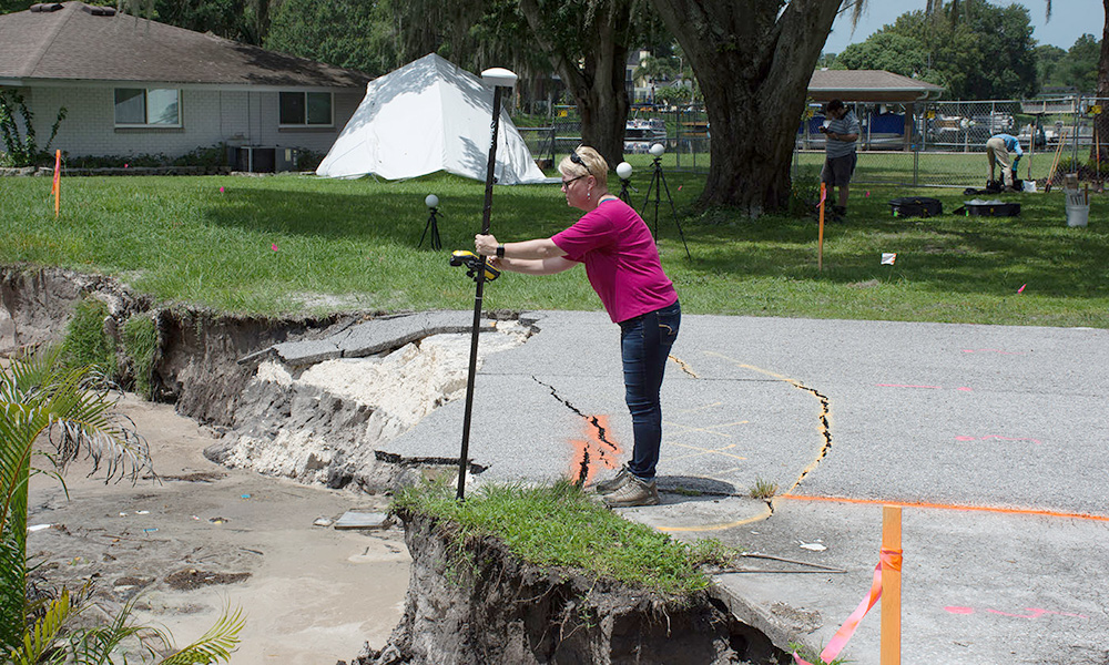
Racing against the clock, the team used various technologies ranging from LiDAR, aerial imagery, FARO Focus 330 3D scanner, and ground-penetrating radar (GPR) with GPS control to collect various data. Changes to the geological site were examined over several weeks.
Unifying The Data Under One Platform For Analysis
A multitude of images and data were collected from the site to create comprehensive 3D surface terrain models for studying the sinkhole growth and advancement. Geomagic Wrap made it easy to collect and analyze many different forms of data from different sources into one digital 3D representation.
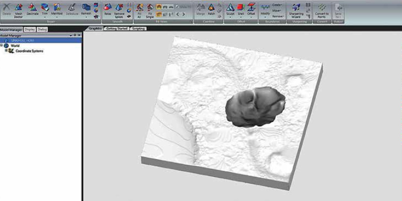
As Collins can attest, “We needed to be able to bring this data to life in a way that was quantifiable. With the help of Geomagic Wrap we were able to do just that. The new features and measurement of Geomagic Wrap have made it easy to collect and analyze many different forms of data in a single software application.”
Sharing The Knowledge With The Public
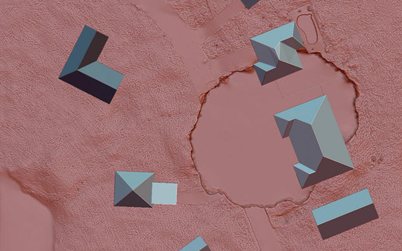
Several printed and digital versions of the model were compared to one another over time as a way to measure the ever-changing sinkhole that would have been proven difficult to trace with the naked eye. Disseminating this information beyond disaster relief officials and decision-makers was important. Consequently, the findings were also publicly shared through the USF Libraries digital collections that extended the reach to other researchers as well as the general public. The power of 3D technology made it easily accessible for anyone to get knowledge about the sinkhole online.
To gain a better understanding of the morphological process, the 3D data from this sinkhole was used to evaluate the elevation of the sinkhole’s water level as it related to that of a neighboring lake. Having the ability to access this type of data from Geomagic Wrap was crucial in assessing how the sinkhole may or may not have been related to the lake and provided a quantifiable way of looking at it.
“This was the largest amount of information that has ever been recorded for one of these events, in part because of these new types of tools. 3D Systems offered a solution that was rapid and effective and has expanded our understanding and ability to respond to and share information during and after a disaster.”
Dr. Lori Collins Research Associate Professor and co-Director of the Digital Heritage & Humanities Center (DHHC) University of South Florida Libraries
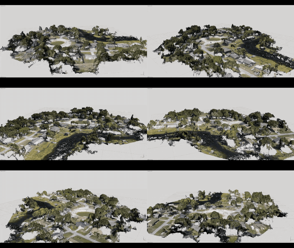
A 3D rendering of a sinkhole site.
Source and credit: USF Libraries, Digital Heritage and Humanities Collections.
Geomagic Wrap provided researchers with a solution to process vast amounts of scan data from different sources and empowered them to analyze, understand, and share the data that would otherwise have not been possible in any other way.
More Information
For more information on the project, please visit:
- USF, Digital Heritage and Humanities Collections website
- USF Sketchfab account
- Dr. Lori Collins Flickr account
Geomagic Wrap
Post-processing software for transforming point-clouds and mesh data into a usable form for downstream applications
Learn MoreSources:
- 3D Systems, Geosciences and Libraries Turn to Geomagic In Wake Of Disaster
- USF, Terrestrial Laser Scanning, UAVs, and GIScience Applications for Sinkhole Documentation
- Science Friday, Uncovering Artifacts And Archaeological Finds With Lasers